
4. Product Guide
The content of Mosaic Hub products is variable and depends on the selection done by the user during the order process. The Product Guide describes all available contents.
4.1. Data
All Mosaic Hub products provide 22 raster bands selectable by the user during the order process (see section Order Panel). Available raster bands comprise:
- 11 surface reflectance bands
- 4 quality indicator bands
- 4 sun/view geometry bands
- 2 validation bands
- 1 quality band
The following chapter give more detailed information on the available bands.
4.1.1. Surface reflectance bands
The Mosaic Hub delivers products with surface reflectance bands chosen by the user in the band selection section of the Mosaic Hub order panel. The surface reflectance is computed using the “Sentinel-2 Atmospheric Correction” (L2A_AtmCorr) algorithm implemented into Sen2Cor and is based on Radiative Transfer Look-Up Tables (LUTs) pre-calculated with LibRadtran.
The following table lists the available bands and corresponding native resolutions of the Sentinel-2 L2A input products.
| Band name | Central Wavelength | Resolution | Unit |
|---|---|---|---|
| B01 | 443 | 60 | None |
| B02 | 490 | 10 | None |
| B03 | 560 | 10 | None |
| B04 | 665 | 10 | None |
| B05 | 705 | 20 | None |
| B06 | 740 | 20 | None |
| B07 | 783 | 20 | None |
| B08 | 842 | 10 | None |
| B08A | 865 | 20 | None |
| B11 | 1610 | 20 | None |
| B12 | 2190 | 20 | None |
4.1.2. Quality indicator bands
All products additionally provide quality indicator bands, if selected by the user.
| Band name | Description | Unit |
|---|---|---|
| quality_aot | Aerosol Optical Thickness (AOT) | None |
| quality_cloud_confidence | Ranging from 0 for high confidence clear sky to 100 for high confidence cloudy. | % |
| quality_snow_confidence | Ranging from 0 for high confidence no snow/ice to 100 for high confidence snow/ice. | % |
| quality_scene_classification | Scene classification map (see Fig. 4.1 & Fig. 4.2) | None |
The following figure shows a list of all quality_scene_classification classes
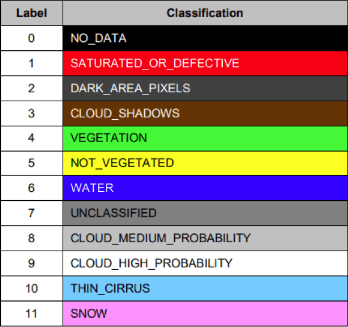
Fig. 4.1 Scene classification map classes
The following figure is an example for a Scene Classification map:
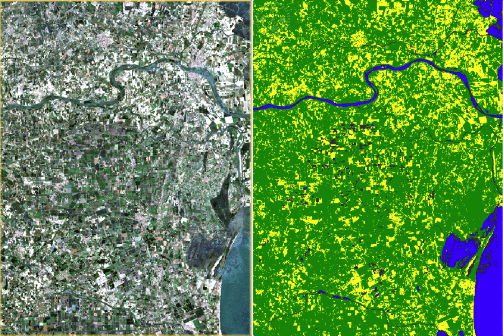
Fig. 4.2 Scene classification map example
4.1.3. View and sun geometry bands
The products additionally provide view and sun geometry information, if selected by the user.
| Band name | Description | Unit |
|---|---|---|
| view_zenith_mean | Mean view zenith angle of all bands | Degree |
| view_azimuth_mean | Mean view azimuth angle of all bands | Degree |
| sun_zenith | Sun zenith angle | Degree |
| sun_azimuth | Sun azimuth angle | Degree |
4.1.4. Validation bands
The products provide information on the validity of an observation (pixel), if selected by the user.
| Band name | Description | Unit |
|---|---|---|
| source_index | Index of the product used for this pixel. See ‘SourceProductIndices’ element in metadata | None |
| valid_obs | Number of valid observations available for the production of this pixel. | None |
4.1.5. Medoid quality bands
Finally, a quality measure for the Medoid compositing algorithm is included, if selected by the user.
| Band name | Description | Unit |
|---|---|---|
| medoid_mos | The measure of spread of the medoid algorithm. Defined as, sum of distances divided by number of observations. | None |
4.2. Resolution
All raster products of the Mosaic Hub are provided in uniform resolution and are available in three different resolutions:
- 10m
- 20m
- 60m
4.3. Coordinate Reference Systems (CRS)
The raster products of the Mosaic Hub are provided either projected in UTM(WGS84) or unprojected (lat/lon) using WGS84.
4.3.1. UTM
The Universal Transverse Mercator (UTM) conformal projection is not a single map projection. Instead, the system divides the Earth into sixty zones, each being a six-degree band of longitude, and uses a secant transverse Mercator projection in each zone. WGS84 is used as ellipsoid for UTM.
4.3.2. WGS84
WGS84 is an Earth-centered, Earth-fixed terrestrial reference system and geodetic datum. WGS84 is based on a consistent set of constants and model parameters that describe the Earth’s size, shape, and gravity and geomagnetic fields.
4.4. File Formats
The Mosaic Hub raster products are available in three different file formats:
- GeoTiff
- Jpeg2000
- NetCDF
The properties of the file formats are described in the following chapter. Where needed, a distinction is made between the different formats.
4.4.1. File Structure
File structures are mainly identical for GeoTiff, Jpeg2000, and NetCDF. Therefore, no explizit chapters for the single formats exist. Differences are indicated within the individual sections.
4.4.1.1. Folders
The Mosaic Hub products are organized in a folder structure. The product’s structure consists of a base folder, containing all data of one order, a sub/tile folder containing one or multiple folders, holding a single product or tiles if a tiling is needed. Within these sub folders, the actual data is stored.
Example of the folder and file structure for the GeoTiff format:

Fig. 4.3 Example of the file/folder structure
4.4.1.2. Files
Depending on the format, the number of files varies.
- GeoTiff/Jpeg2000:
- The product is delivered in 23 separate files. 22 GeoTiff/Jpeg2000 files contain the raster bands described in the ‘Data’ section, one JSON file containing metadata information, and one XML file also containing INSPIRE conform metadata information.
- NetCDF:
- The product is delivered in 2 separate files. One NetCDF file containing all raster bands, one JSON file containing metadata information, and one XML file also containing INSPIRE conform metadata information.
4.4.1.3. Tiling
The product is split into the area of original Sentinel-2 granules. For a detailed description of the Sentinel-2 tiling scheme please visit the official website. A tiling of the products is only done if the UTM projection is chosen as CRS and the chosen area exceeds a certain size.
4.4.2. Naming conventions
Naming conventions are mainly identical for GeoTiff, Jpeg2000, and NetCDF. Therefore, no explicit chapters for the individual formats exist (differences are indicated where necessary).
The product name (folders & files) contains key information on its content. Product names support easy identification of relevant files and support meaningful sorting. The Mosaic Hub product names are constructed according to the following naming convention:
4.4.2.1. Base folder
S2GM_{TemporalIdentifierSpatialIdentifier}_{PeriodStart}_{PeriodEnd}_{OrderName}_[ConfIndicator] _v{Version}_[{uniqueID}].{FileExtension}
In short, and with the correct length indicated by placeholders:
S2GM_{TSS}_{SSSSSSSS}_{EEEEEEEE}_{AA…AA}_[CCC]_v{X.Y.Z}_[DDD}.{ext}
- Two examples:
- S2GM_Q10_20171001_20171230_MyPersonalRequest_STD__v1.0.0_385.tiff S2GM_M60_20170401_20170430_SPAIN_STD__v1.0.0_420.netCDF
| Identifyer | Description | Values / format |
|---|---|---|
| T | Temporal identifier | D … daily |
| T … 10day | ||
| M … monthly | ||
| Q … quarterly | ||
| Y … yearly | ||
| SS | Spatial identifier | 10 … 10m |
| 20 … 20m | ||
| 60 … 60m | ||
| SSSSSSSS | Start date of the mosaicking period | YYYYMMDD |
| EEEEEEEE | End date of the mosaicking period | YYYYMMDD |
| AA…AA | Order name | Variable number of characters which can be freely chosen by a user |
| CCC | Configuration indicator. Identifier for the different pre-defined configurations offered to users. | STD … all defaults settings |
| VEG … vegetation preference | ||
| SOI … bare soil preference | ||
| vX.Y.Z | Processing baseline version. Processing baseline comprise a certain set of software and auxiliary data. | The version of the processing system, in the format X.Y.Z |
| DDD | Order number | Order number: Arbitrary 3 digits identifier. A unique number assigned for every product |
| ext | FileExtension | Depending on the file format it can be nc, tiff or jp2 |
4.4.2.2. Subfolders
The naming of the subfolders differ for tiled and none-tiled products (see tiling).
Non-tiled products: The subfolder name is equal to the order name (see {AA…AA} in base folder table)
Tiled products: The subfolder names are equal to Sentinel-2 granule names (see tiling)
4.4.2.3. Files
The file naming differs for GeoTiff/Jpeg2000 and NetCDF due to the structuring of the files.
GeoTiff/Jpeg2000:
For the GeoTiff and Jpeg2000 format, all raster bands are stored as separate files (see Files)
{RasterBandIdentifier}_{TemporalIdentifierSpatialIdentifier}_{PeriodStart}_{OrderName}.{FileExtension}
In short, and with the correct length indicated by placeholders (if not variable; variability indicated by …):
{BB…BB}_{TSS}_{SSSSSSSS}_{AA…AA}.{ext}
Example: B04_M60_20170701_Northern_Germany.jp2
| Identifyer | Description | Values / format |
|---|---|---|
| BB…BB | Band name identifier | Variable number of characters indicating the band name |
| T | Temporal identifier | D … daily |
| T … 10day | ||
| M … monthly | ||
| Q … quarterly | ||
| Y … yearly | ||
| SS | Spatial identifier | 10 … 10m |
| 20 … 20m | ||
| 60 … 60m | ||
| SSSSSSSS | Start date of the mosaicking period | YYYYMMDD |
| AA…AA | Order name | Variable number of characters which can be freely chosen by a user |
| ext | FileExtension | Depending on the file format it can be tiff or kp2 |
NetCDF
For the NetCDF format, all raster bands are stored in a single NetCDF (.nc) file (see Files)
{TemporalIdentifierSpatialIdentifier}_{PeriodStart}_{OrderName}.{FileExtension}
In short, and with the correct length indicated by placeholders (if not variable; variability indicated by …):
{TSS}_{SSSSSSSS}_{AA…AA}.{ext}
- Example:
M60_20170701_Northern_Germany.nc
metadata_20170701_Northern_Germany.json
| Identifyer | Description | Values / format |
|---|---|---|
| T | Temporal identifier | D … daily |
| T … 10day | ||
| M … monthly | ||
| Q … quarterly | ||
| Y … yearly | ||
| SS | Spatial identifier | 10 … 10m |
| 20 … 20m | ||
| 60 … 60m | ||
| SSSSSSSS | Start date of the mosaicking period | YYYYMMDD |
| AA…AA | Order name | Variable number of characters which can be freely chosen by a user |
| ext | FileExtension | Depending on the file format it can be nc |
The metadata file is prefixed with ‘metadata/_’
4.4.3. Metadata
The intention of the metadata provided with the Sentinel-2 mosaics is to deliver transparent information about the production process and useful technical details facilitating the further use of the data. Each mosaic contains metadata in terms of an XML (INSPIRE-compliant) and JSON (containing additional relevant metadata) file. In addition, data which has been ordered in the NetCDF format will have metadata included internally. The metadata can be grouped into the following categories:
- General metadata which contain quasi static information, such as the name of the service, contact information, etc. These are primarily emerging from INSPIRE requirements and are reported in an INSPIRE-compliant XML file.
- Production metadata provide detailed information how the product has been produced including production date and time, algorithm version, information of data lineage, and the list of Sentinel-2 input products linked with the source index file (included in the JSON file).
- Quality indicators at product level are stored in the quality metadata group (included in the JSON file).
- In addition, variable metadata provide information on specific variables. Several items of them reveal technical details (scaling and offset parameters, units, etc.) on the way the data is organised in the file, which can then be interpreted by the software reading the data. (included in the JSON file).
The GeoTiff / Jpeg2000 files contain the INSPIRE-compliant XML and a JSON file, while the NetCDF additionally includes the same information in the internal metadata.
The following tables describe the metadata used in the JSON file:
| Name | Valid Range | Units | Scaling Factor | Description |
|---|---|---|---|---|
| Title | N/A | unitless | N/A | This a characteristic, and often unique, name by which the resource is known. |
| Summary | N/A | unitless | N/A | This is a brief narrative summary of the content of the resource. |
| Project | N/A | unitless | N/A | Project name |
| Institution | N/A | unitless | N/A | Project institutions |
| References | N/A | unitless | N/A | webpage of responsible party |
| Contact | N/A | unitless | N/A | This is the description of the organisation responsible for the creation and maintenance of the resource |
| License | N/A | unitless | N/A | Privacy policy and terms of use |
| Creator_url | N/A | unitless | N/A | webpage of responsible party |
| Creator_email | N/A | unitless | N/A | email of responsible party |
| Metadata_version | 0 to ∞ | unitless | N/A | Metadata version number (1.0.1, …) |
| Processing_baseline | 0 to ∞ | unitless | N/A | Processing version number (0.1.0, …) also reflected in the filename. |
| Processing_name | N/A | unitless | N/A | A value uniquely identifying the resource including version, baseline, resolution, composite period |
| Compositing_period | N/A | unitless | N/A | Specify time period for which mosaic is valid |
| Processing_steps | N/A | unitless | N/A | Corrections applied to data, e.g., atmospheric, cirrus, terrain, BRDF, and geometric corrections |
| Processing_configuration | N/A | N/A | Configuration of process | |
| Resource_locator | N/A | unitless | N/A | web of product |
| Sensor_list | N/A | unitless | N/A | List of used sensors |
| Mosaicking_period_start | 1 to 366 | date | N/A | start date of product |
| Mosaicking_period_end | 1 to 366 | date | N/A | end date of product |
| First_product_date | 1 to 366 | date | N/A | start date of product in case of more tiles |
| Last_product_date | 1 to 366 | date | N/A | end date of product in case of more tiles |
| Resolution_distance | 10 to 60 | m | N/A | A resolution distance shall be expressed as a numerical value associated with a unit of length. |
| Date_of_creation | 1 to 366 | date | N/A | date of product genertation |
| Source_product_list | S2A | S2B | unitless | N/A | Internal list of input filenames used for production. |
| Geometry / Image_width | 0 to 10000 | unitless | N/A | size of resource, number of pixel in x-direction |
| Geometry / Image_height | 0 to 10001 | unitless | N/A | size of product, number of pixel in y-direction |
| Geometry / CRS | N/A | unitless | N/A | coordinate system of resource |
| Geometry / Projection_parameters | N/A | unitless | N/A | projection parameters |
| Geometry / Boundary |
|
unitless | 1 | This is the extent of the resource in the geographic space, given as a bounding box. The bounding box shall be expressed with westbound and eastbound longitudes, and southbound and northbound latitudes in decimal degrees, with a precision of at least two decimals. |
| Name | Valid Range | Units | Scaling Factor | Description |
|---|---|---|---|---|
| file identifier | N/A | unitless | N/A | A value uniquely identifying the resource |
| Metadata language | N/A | unitless | N/A | Language code |
| Point of contact (metadata) - organisationName | N/A | unitless | N/A | This is the description of the organisation responsible for the creation and maintenance of the metadata. |
| Point of contact (metadata) - electronicMailAddress | N/A | unitless | N/A | Contact e-mail address |
| Responsible party / Organisation Name | N/A | unitless | N/A | This is the description of the organisation responsible for the establishment, management, maintenance and distribution of the resource. |
| Responsible party / E-Mail Address | N/A | unitless | N/A | Contacting e-mail address for responsible party |
| Metadata date | 1-366 | unitless | 1 | The date which specifies when the metadata record was created or updated. |
| Resource title | N/A | unitless | N/A | This a characteristic, and often unique, name by which the resource is known |
| Identifier Code | N/A | unitless | N/A | A value uniquely identifying the resource. |
| Resource abstract | N/A | unitless | N/A | This is a brief narrative summary of the content of the resource. |
| Resource locator | N/A | unitless | N/A | The resource locator defines the link(s) to the resource and/or the link to additional information about the resource. |
| Topic category | N/A | unitless | N/A | The topic category is a high-level classification scheme to assist in the grouping and topic-based search of available spatial data resources. |
| Keyword from INSPIRE Data themes | N/A | unitless | N/A | The keyword value is a commonly used word, formalised word or phrase used to describe the subject. While the topic category is too coarse for detailed queries, keywords help narrowing a full text search and they allow for structured keyword search. |
| Keyword from repositories | N/A | unitless | N/A | |
| Free keyword | N/A | unitless | N/A | The keyword value is a commonly used word, formalised word or phrase used to describe the subject. While the topic category is too coarse for detailed queries, keywords help narrowing a full text search and they allow for structured keyword search. |
| Originating controlled vocabulary | N/A | unitless | N/A | If the keyword value originates from a controlled vocabulary (thesaurus, ontology), for example GEMET, the citation of the originating controlled vocabulary shall be provided. This citation shall include at least the title and a reference date (date of publication, date of last revision or of creation) of the originating controlled vocabulary. |
| Date of creation | 1-366 | unitless | 1 | This is the date of creation of the resource. There shall not be more than one date of creation. |
| Date of publication | 1-366 | unitless | 1 | This is the date of publication of the resource when available, or the date of entry into force. There may be more than one date of publication. |
| Date of last revision | 1-366 | unitless | 1 | This is the date of last revision of the resource, if the resource has been revised. There shall not be more than one date of last revision. |
| Conditions applying to access and use | N/A | unitless | N/A | This metadata element defines the conditions for access and use of spatial data sets and services, and where applicable, corresponding fees as required by Article 5(2)(b) and Article 11(2)(f) of Directive 2007/2/EC. |
| Limitations on public access | N/A | unitless | N/A | When Member States limit public access to spatial data sets and spatial data services under Article 13 of Directive 2007/2/EC, this metadata element shall provide information on the limitations and the reasons for them. If there are no limitations on public access, this metadata element shall indicate that fact. |
| Resolution distance | 10 to 60 | m | N/A | A resolution distance shall be expressed as a numerical value associated with a unit of length. |
| Unit of measure | N/A | m | N/A | A resolution distance shall be expressed as a numerical value associated with a unit of length. |
| Geographic bounding box |
|
unitless | 1 | This is the extent of the resource in the geographic space, given as a bounding box. The bounding box shall be expressed with westbound and eastbound longitudes, and southbound and northbound latitudes in decimal degrees, with a precision of at least two decimals. |
| Temporal extent / Starting date | 1-366 | unitless | 1 | The temporal extent defines the time period covered by the content of the resource. This time period may be expressed as any of the following: - an individual date, - an interval of dates expressed through the starting date and end date of the interval, - a mix of individual dates and intervals of dates. |
| Temporal extent / Ending date | 1-366 | unitless | 1 | The temporal extent defines the time period covered by the content of the resource. This time period may be expressed as any of the following: - an individual date, - an interval of dates expressed through the starting date and end date of the interval, - a mix of individual dates and intervals of dates. |
| Conformity | N/A | m | N/A | This is a citation of the implementing rules adopted under Article 7(1) of Directive 2007/2/EC or other specification to which a particular resource conforms. A resource may conform to more than one implementing rules adopted under Article 7(1) of Directive 2007/2/EC or other specification. This citation shall include at least the title and a reference date (date of publication, date of last revision or of creation) of the implementing rules adopted under Article 7(1) of Directive 2007/2/EC or of the specification. |
| Lineage | N/A | m | N/A | This is a statement on process history and/or overall quality of the spatial data set. Where appropriate it may include a statement whether the data set has been validated or quality assured, whether it is the official version (if multiple versions exist), and whether it has legal validity. |
The following band interpretation items are valid for each band:
| Name | Valid Range | Units | Scaling Factor | Description |
|---|---|---|---|---|
| Band Name | N/A | unitless | N/A | name of each band |
| Description | N/A | unitless | N/A | description of band |
| Spectral_information | 0 to 16000 | unitless | 1/10000 | information about wavelength and bandwidth |
| Unit | N/A | m | N/A | A resolution distance shall be expressed as a numerical value associated with a unit of length. |
| No_data_value | -32768 to 65535 | unitless | 1 | no data value of resource |
| Scaling_factor | 0 to ∞ | unitless | 1 | number which scales, or multiplies, some quantity. |
| File_path | N/A | unitless | N/A | file name of resource |
| File_format | N/A | unitless | N/A | file format of resource |
4.5. Software
In this section, you will get a brief introduction how to open Mosaic Hub products in SNAP or QGIS. The introduction is limited to the two most common open source platforms used for Sentinel-2 data.
4.5.1. SNAP
SNAP stands for Sentinel Aplication Platform and is the official ESA software and common architecture for all Sentinel Toolboxes. It can be downloaded at: http://step.esa.int/main/download/
The simplest way of directly using the Mosaic Hub products is by using SNAP. In SNAP you can simply select the .json file in the open file dialogue box or drag and drop the .json file on the “Product Explorer” window. There is no difference if the product is delivered in GeoTiff, Jpeg2000 or NetCDF format.
A precondition for working with the mosaics is to install the S2GM SNAP reader plugin as described here.
Open product:
- Select “File” -> “Open Products…” -> select “.json” file (see figure 4.4 and 4.5) or
- Drag & drop .json file on the “Product Explorer” part in SNAP (see figure 4.6).
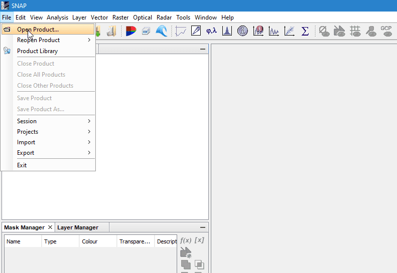
Fig. 4.4 SNAP example: Open with file explorer
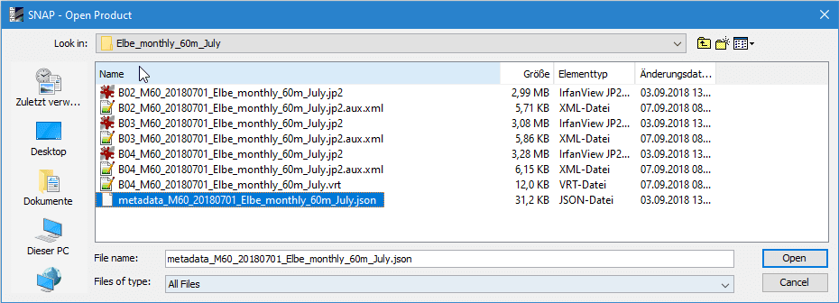
Fig. 4.5 SNAP example: Select .json file

Fig. 4.6 SNAP example: Open via drag & drop
Afterwards the product will be shown in the “Product Explorer” window. Now you can investigate the content of the product by clicking on the “+” signs. To view the product, right-click on the product name in the “Product Explorer” and select “Open RGB Image Window”. In the “Select RGB-Image Channels” window choose a band combination that fits your needs. In this example, the combination of Bands 4, 3, and 2 were used for RGB.
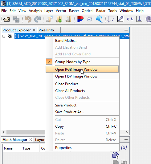
Fig. 4.7 SNAP example: Open RGB view
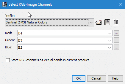
Fig. 4.8 SNAP example: Select RGB profile (e.g. 4/3/2)
The selected RGB combination will be shown in a new window.
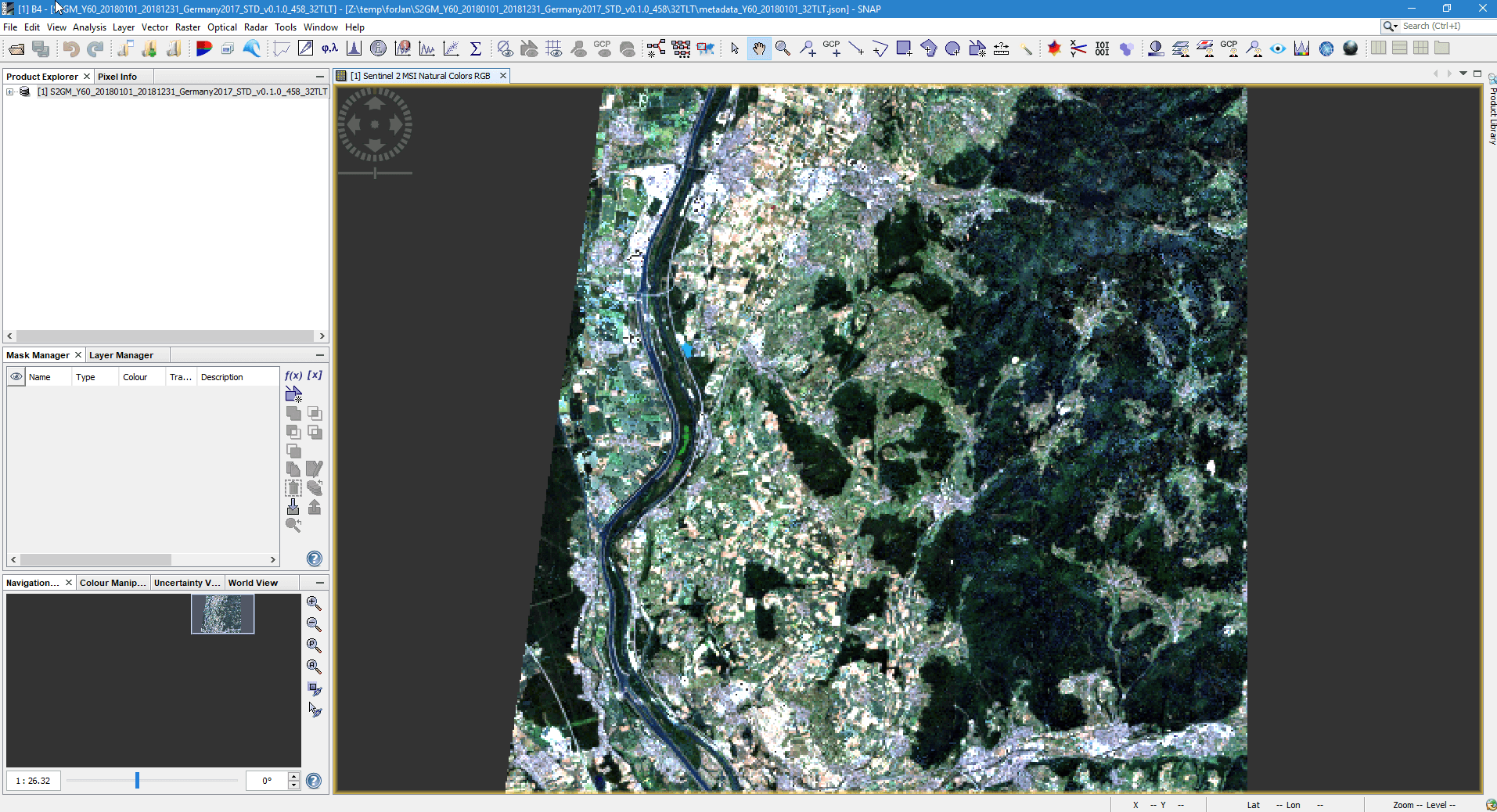
Fig. 4.9 SNAP example: RGB of bands 4/3/2
4.5.1.1. Install the S2GM SNAP reader plugin
1. Start SNAP Desktop. Open the Plugin Manager. From the menu select Tools –> Plugins:
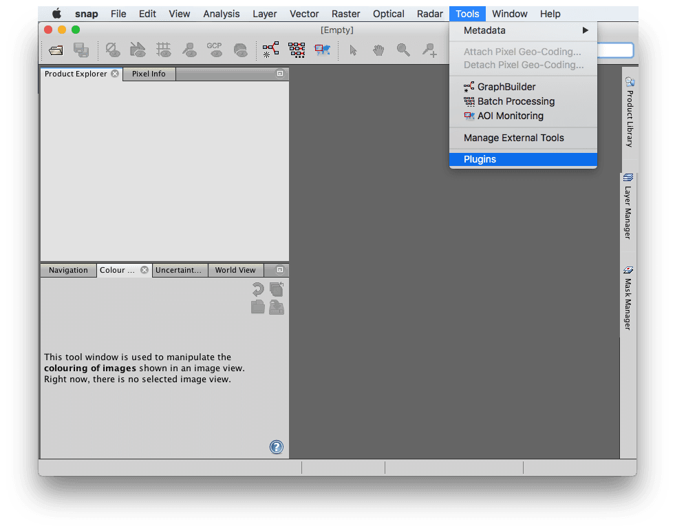
Fig. 4.10 Open the Plugin Manager in SNAP
2. In the “Available Plugins” tab of the Plugin Manager, select the S2GM SNAP Plugins by ticking the “Install” check box. Click on the Install button in order to start the installation process.
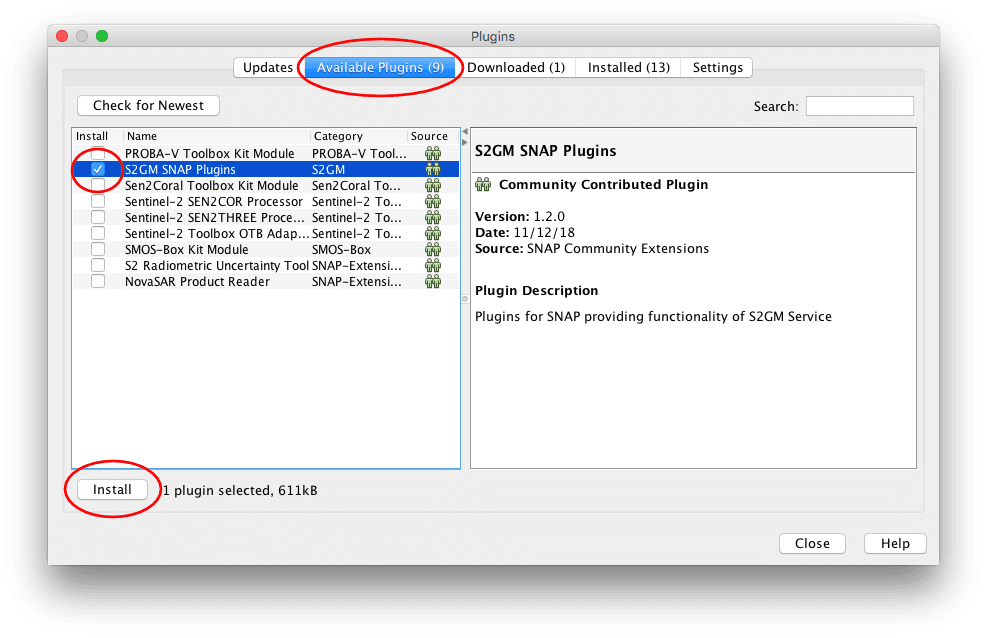
Fig. 4.11 Select the S2GM Plugin to install
- Confirm the installation. Click on Next.

Fig. 4.12 Confirm Installation
4. It might be necessary to accept the license agreement. Click on Install. The download and the installation starts.

Fig. 4.13 Accept License Agreement
- Because the S2GM SNAP plugin has unsigned code, you have to confirm the installation again by clicking on Continue:
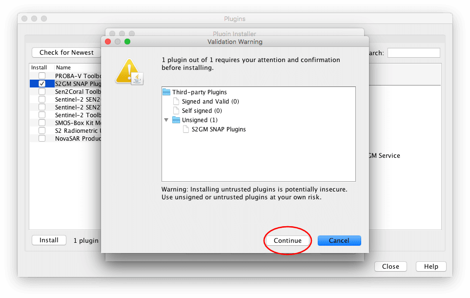
Fig. 4.14 Trust unsigned plugin
- In order to finalise the installation, SNAP Desktop needs to be restarted. Choose if you want to restart now or later and click Finish.
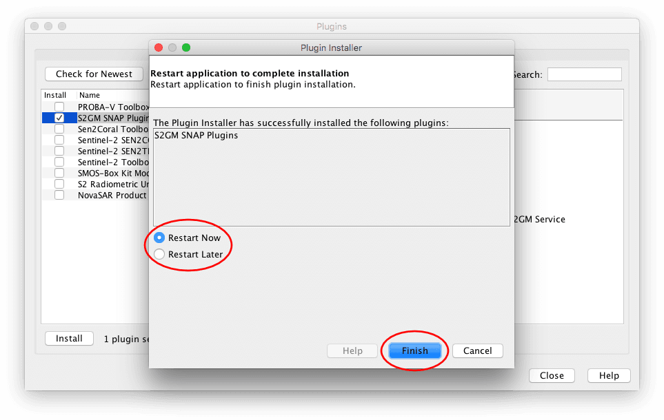
Fig. 4.15 Complete installation dialog
4.5.2. QGIS
QGIS users need to apply more steps to visually inspect the product.
GeoTiff/Jpeg2000
You have two options of inspecting the data in QGIS. You can either load all single raster bands and inspect them as grey scale images, or you can create a raster stack and inspect an RGB image. For the first option you can either:
- Drag & drop the single bands (.tiff/.jp2) directly on the “Layers” window or
- Use the “Add Raster Layer” button and select the single files and add them to QGIS.
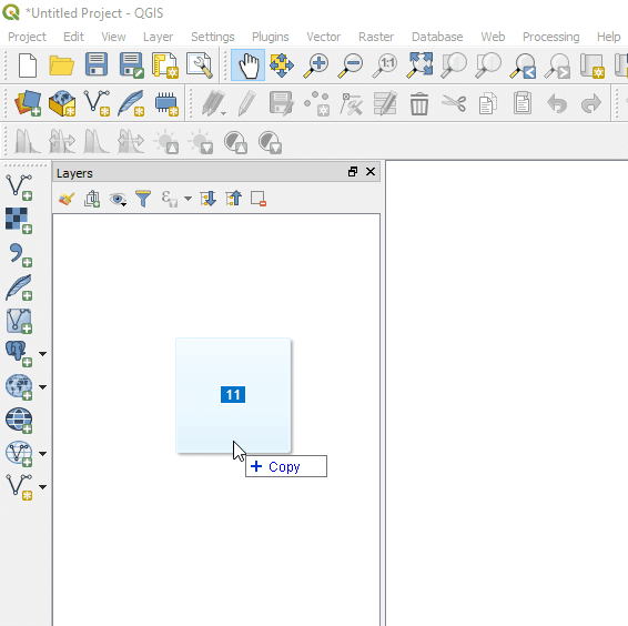
Fig. 4.16 QGIS example: Drag & drop files
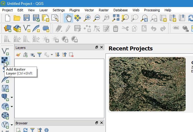
Fig. 4.17 QGIS example: Open with “Add Raster Layer”
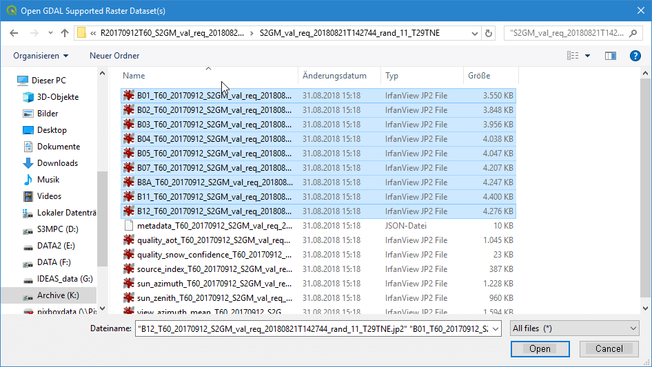
Fig. 4.18 QGIS example: Sselect .jp2/.tiff files
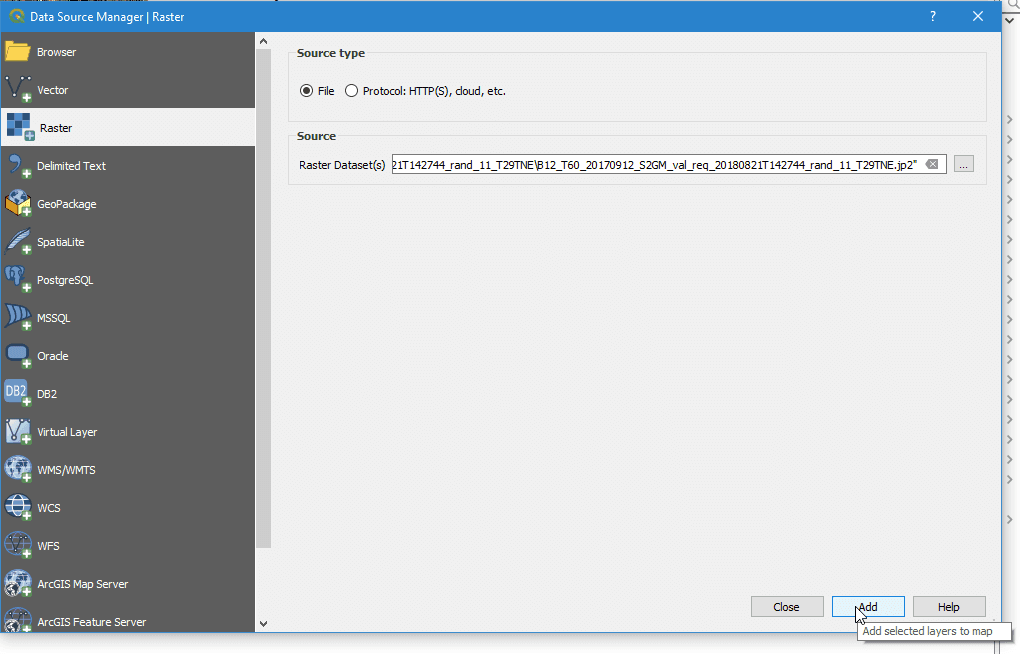
Fig. 4.19 QGIS example: Load files into QGIS
If you use these two options, you will end up with single raster bands in QGIS which you can inspect as greyscale images.
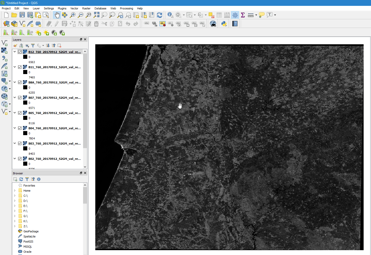
Fig. 4.20 QGIS example: single raster files as grey scale images
If you want to create a raster stack from which you can create an RGB view, you first have to stack the single files. For this again two options exist. Either you merge the data into a single raster stack or you create a GDAL Virtual Raster called VRT.
For the first option, you need to select “Raster” -> “Miscellaneous” -> “Merge…”. Click Add files(s) and select the files you like to stack. Then click OK. Make sure you check the “Place each input file into a seperate band” check-box. Click the […] button and select Save to “File…”. Depending on your preferences you can choose between different output formats like GeoTiff. If you choose GeoTiff, you might wish to build image pyramids for faster display later on.

Fig. 4.21 QGIS example: Select “Merge…” tool
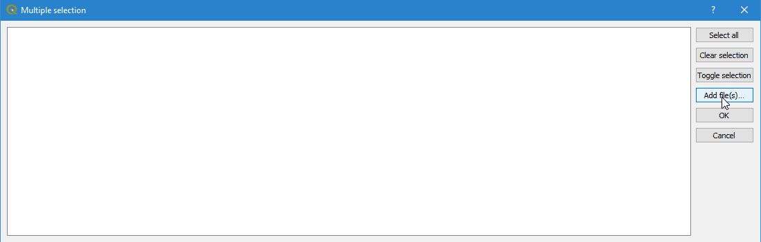
Fig. 4.22 QGIS example: Select files

Fig. 4.23 QGIS example: Add files - OK
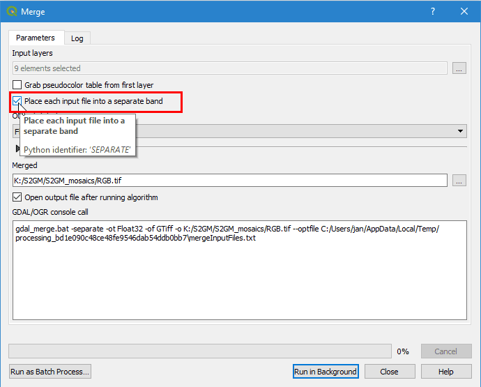
Fig. 4.24 QGIS example: Check tick-box for file separation
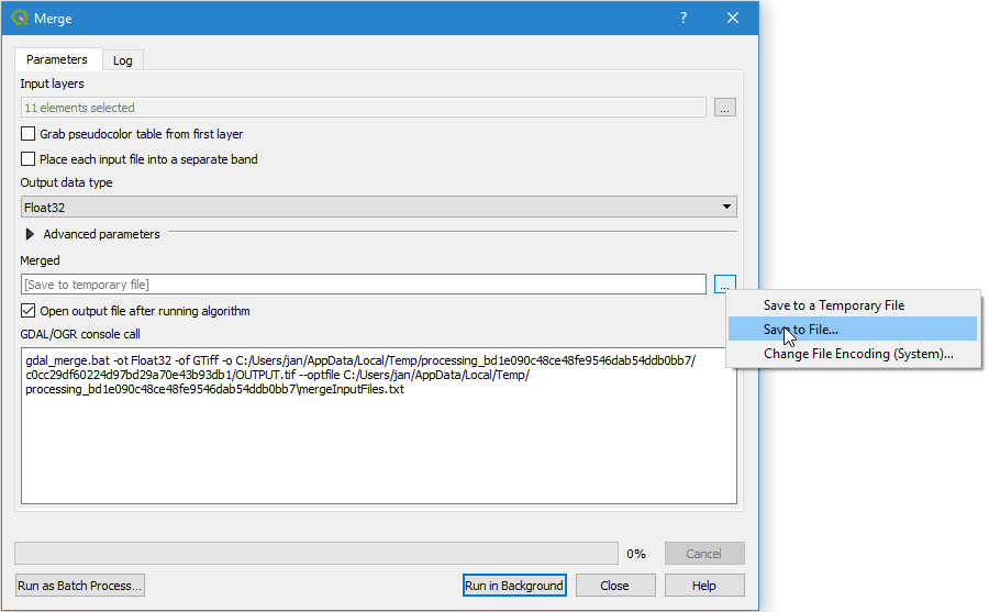
Fig. 4.25 QGIS example: Choose output format
If you decide to create a virtual raster stack (VRT), you need to select “Raster” -> “Miscellaneous” -> “Build Virtual Raster…”. The steps are the same as for “Merge..”. Again make sure to check “separate”. The generated product is very small, as it is only a reference to the real data, but it will be slow for the display of bigger images.

Fig. 4.26 QGIS example: Select “Build Virtual Raster…” tool
Once one of the two processes is finished, the resulting layer stack will be loaded into QGIS. Now you can open the layer’s property window and select the bands you like to view as an RGB. For this example we have chosen R/G/B = 4/3/2. Afterwards your selection will be displayed in QGIS.
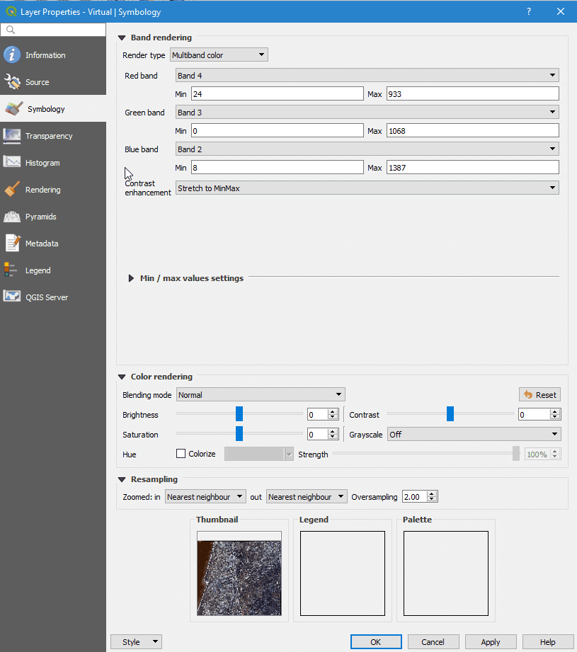
Fig. 4.27 QGIS example: Select band combination in properties window

Fig. 4.28 QGIS example: RGB image bands 4/3/2 in QGIS
NetCDF
For the NetCDF format, there are small differences. Again, you can either use drag & drop or “Add Raster Layer” as described above. After you have selected or dropped your NetCDF file, a new window opens where you can select the raster layer of the NetCDF you like to add. Afterwards you have to indicate the CRS you are using. All selected raster bands will be added to QGIS. Now you can proceed the same way as described above. Either you merge the data or build a VRT. Either way, the added files will show up in the file selection window. Therefore, no files have to be added, just simply selected. All remaining steps are the same as for GeoTiff/Jpeg2000
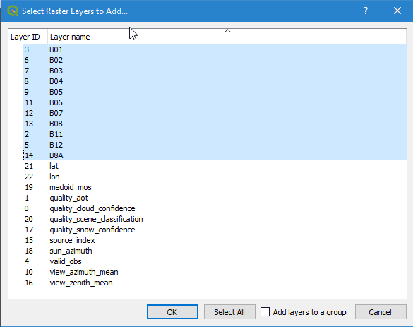
Fig. 4.29 QGIS example: Add NetCDF bands in QGIS
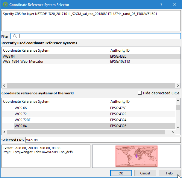
Fig. 4.30 QGIS example: Select CRS
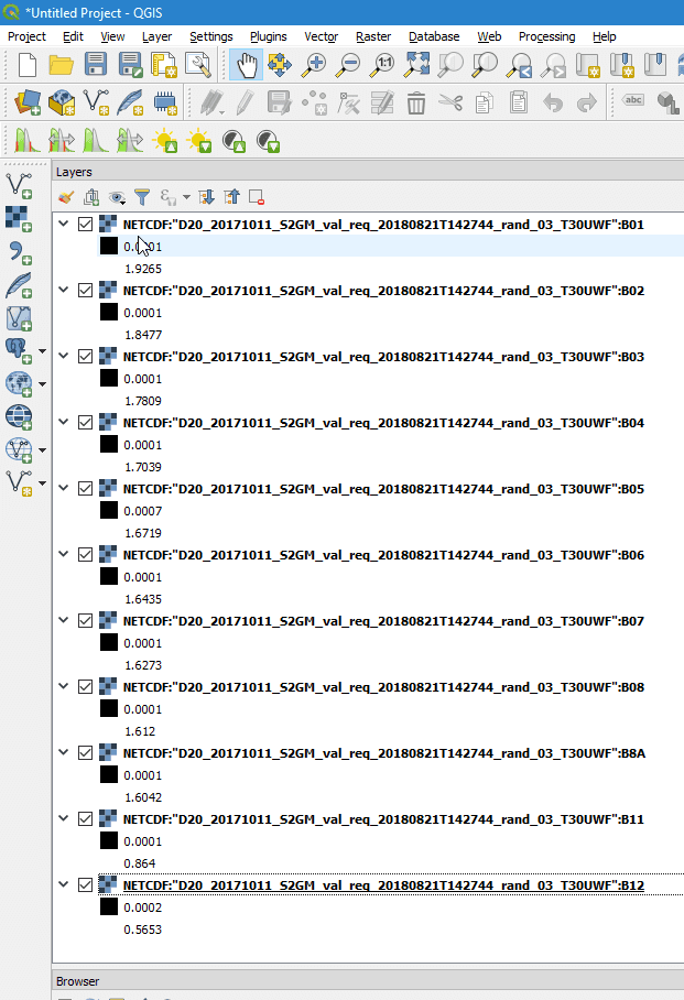
Fig. 4.31 QGIS example: All NetCDF raster bands are added to QGIS
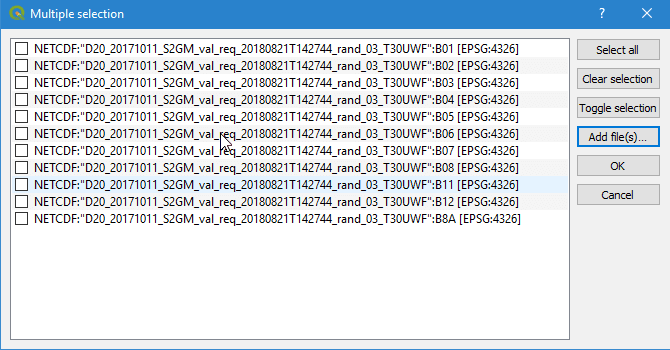
Fig. 4.32 QGIS example: Select files
4.6. Time Series
Besides raster products, the Mosaic Hub provides the functionality of extracting time series of a single pixel or 3x3 pixel window. The result of those extractions can be exported and downloaded. For a full description of this functionality, please see TimeSeries
4.6.1. File Format
The time series extracts are provided in CSV format.